After bumping onto the beach with a van full of our kit, we were amazed when Duncan had everything and more needed to make a 20 minute shore dive in 2.1 meters of water. Twin 15L tanks of air? Check. A small square of carpet on which to stand to avoid sticking sandy feet into his impressive dry suit? Check. Lee cut a mean figure in his stunning new red trimmed drysuit, while Jordyan struggled valiantly through the neck hole of her suit. A few squirts of lubricant from Duncan's bag-o-tricks, and her head popped through with minimal hair loss.
While the pupils were having fun and games, Mark and Mary made sure we had a sound risk assessment form prepared. All potential safety concerns were mitigated and back up plans were in place (just in case the Coast Guard was called to evacuate us from our site, 50 meters offshore.)
 Finally we were in with slates, measuring tapes, and cameras all around. Camera (singular), as it was Mary who hovered around us, waiting for just the right shot of us not dangling by our heels. We drew objects in our crosshatched planning frames and spooled out measuring tape from point to point. Guess who was at the "dumb end" of the tape?
 We were a bit cocky on dry land about our surprisingly natural offset and trilateration measurement skills. (especially Lee on the left!) But once we were tasked to practice these skills underwater, we started to believe Mary's warning. It is a bit more difficult to be accurate in scribbling our notes while managing our buoyancy and smiling for the camera.
 The swell! The vis! I couldn't find my pencil! You were right Mary, that was tough. What's that? We were in ideal conditions?? Oh no. (we thought we heard Duncan talking to himself)
 2D underwater survey techniques were just the beginning. Before we were allowed to eat lunch, we had to run the ropes course on the front patio. We took measurements between control points and artefacts, as well as adding the element of depth to the equation.
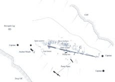
  And equations it was! After entering the data into Site Recorder, we were amazed as the software corrected most of our off measurements and create a map of the site instantly. It even used simple color coding to point out which data we might want to think about re-measuring - just in case we were interested in being accurate. (Lee to Jordyan: "weren't you 3 meters away, not 3 centimeters?!")
 The afternoon found us in the driveway, bagging "artefacts" in the "loch". On with the gloves, squat down over the bin of muddy water and ("trust me! there really are three artefacts" laughed Mary)' on the bottom which we must avoid exposing to air by bagging and labelling before bringing to the surface.
  We decided as a group that Lee's bit of slate did not have significant enough archaeological value to qualify to be bagged and tagged, so back in it went. Mary - Please don't follow through on your suggestion that we practice blindfolded!
 Jordyan's undated "old bit of iron peg" pierced the plastic bag, so were treated to a lecture about the use of household items in archaeology, including old ice cream containers, cat litter trays, and tupperware.
 Tomorrow morning will find us dancing across the sands of Lochaline Beach and dunking down 2 meters for our final practice survey, then a treat tomorrow afternoon! - a fun dive on the Shuna, wrecked in 1913. And now, off to the Club...

No comments:
Post a Comment